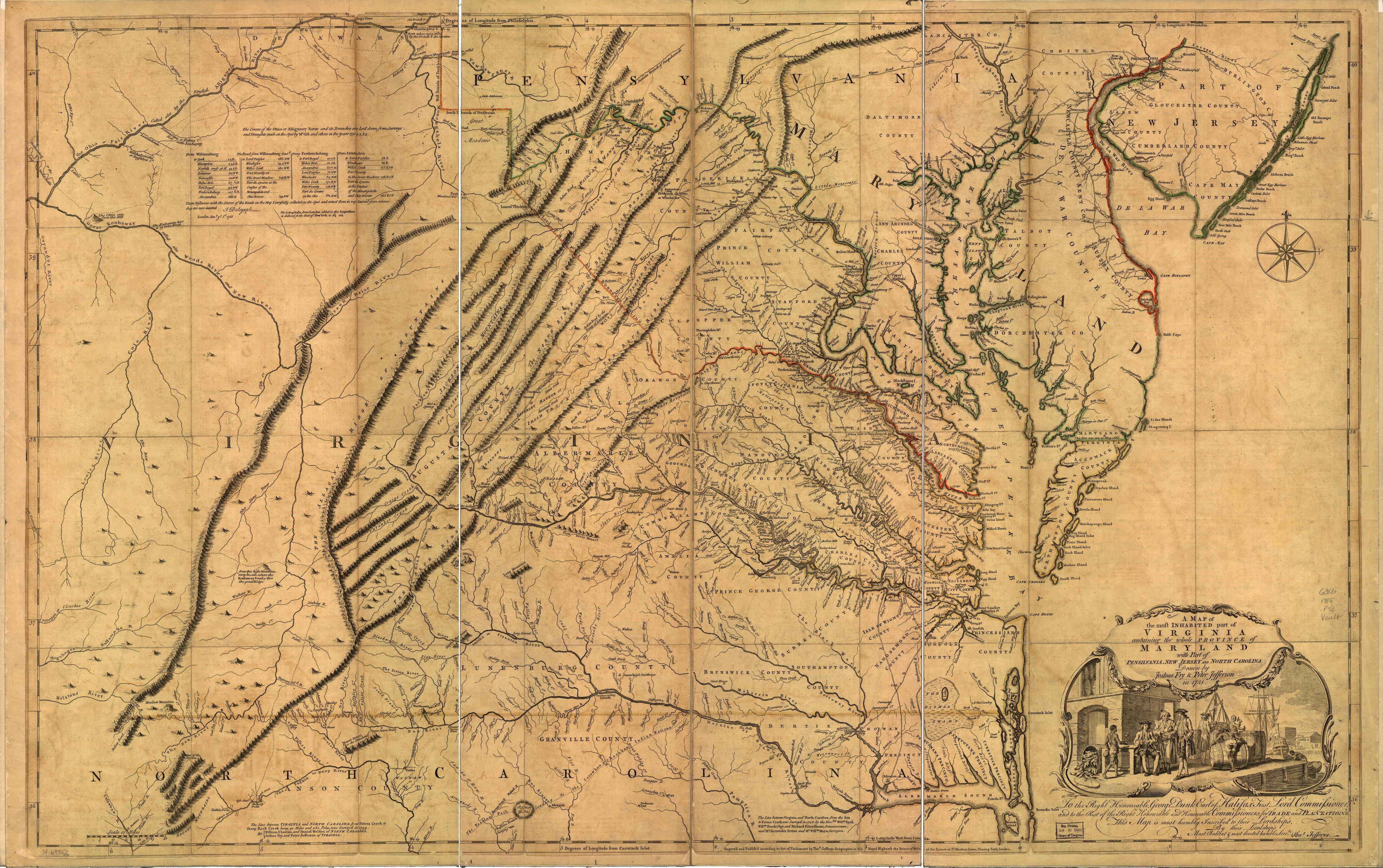
A map of the most inhabited part of Virginia containing the whole province of Maryland with part of Pensilvania, New Jersey and North Carolina.
Item
Creator
Fry, Joshua, approximately 1700-1754.
Jefferson, Peter, 1708-1757, joint author.
Jefferys, Thomas, -1771.
Jefferson, Peter, 1708-1757, joint author.
Jefferys, Thomas, -1771.
Title
A map of the most inhabited part of Virginia containing the whole province of Maryland with part of Pensilvania, New Jersey and North Carolina.
Description
Scale ca. 1:650,000. Hand colored. Prime meridian: Philadelphia and Curratuck Inlet. Relief shown pictorially. "To the Right Honourable, George Dunk Earl of Halifax ..." LC Maps of North America, 1750-1789, 1428 Includes distance chart added by "J. Dalrymple, London Jany. ye. 1st. 1755." Available also through the Library of Congress Web site as a raster image. Vault AACR2
Date
1700-1754
1708-1757
1771
1708-1757
1771
Source
Library of Congress
Contributor
Viar, Anastasia
Bibliographic Citation
Fry, Joshua, et al. “A Map of the Most Inhabited Part of Virginia Containing the Whole Province of Maryland with Part of Pensilvania, New Jersey and North Carolina.” A Map of the Most Inhabited Part of Virginia Containing the Whole Province of Maryland: with Part of Pensilvania, New Jersey and North Carolina, Thos. Jeffreys, 1755.