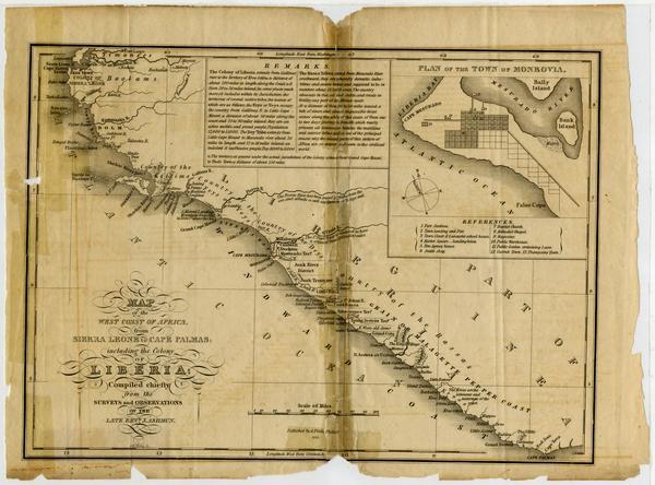
Map of the west coast of Africa from Sierra Leone to Cape Palmas, including the Colony of Liberia.
Item
Creator
Ashmun, J. (Jehudi), 1794-1828. (surveyor)
Title
Map of the west coast of Africa from Sierra Leone to Cape Palmas, including the Colony of Liberia.
Description
Fold-out plate detached from: The thirteenth annual report of American Society for Colonizing the Free People of Colour of the United States. -- Washington, 1830. Includes descriptive and historical Remarks. Heights shown pictorially; depths shown with gradient tints of gray. Inset: Plan of the town of Monrovia.
Date
1830
Source
Presbyterian Historical Society, Philadelphia, PA
Contributor
Rogers, Tammy
Bibliographic Citation
Map of the west coast of Africa from Sierra Leone to Cape Palmas, including the Colony of Liberia.. 1830. Retrieved from the Digital Public Library of America, https://digital.history.pcusa.org/islandora/object/islandora%3A140082. (Accessed July 18, 2021.)
