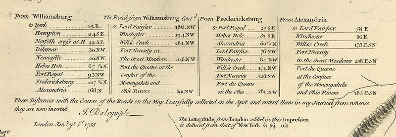
Dalrymple Table.
Item
Creator
Dalrymple, Col. Joshua
Title
Dalrymple Table.
Description
Table of Distances printed on the Fry and Jefferson Map of Virginia
Date
1755
Source
A Map of the Most Inhabited Parts of Virginia. Map Collection. Library of Virginia, Richmond, Virginia.
Contributor
Farrell, Cassandra
Bibliographic Citation
Fry, Joshua, Peter Jefferson, and Thomas Jefferys. “A Map of the Most Inhabited Part of Virginia Containing the Whole Province of Maryland : with Part of Pensilvania, New Jersey and North Carolina ” London: ... Published according to Act of Parliament by Thos. Jefferys, geographer to His Royal Highness the Prince of Wales at the corner of St. Martins Lane, Charing Cross, London, 1755.
Spatial Coverage
Virginia, USA.
