The Making of Mr. Madison's Map
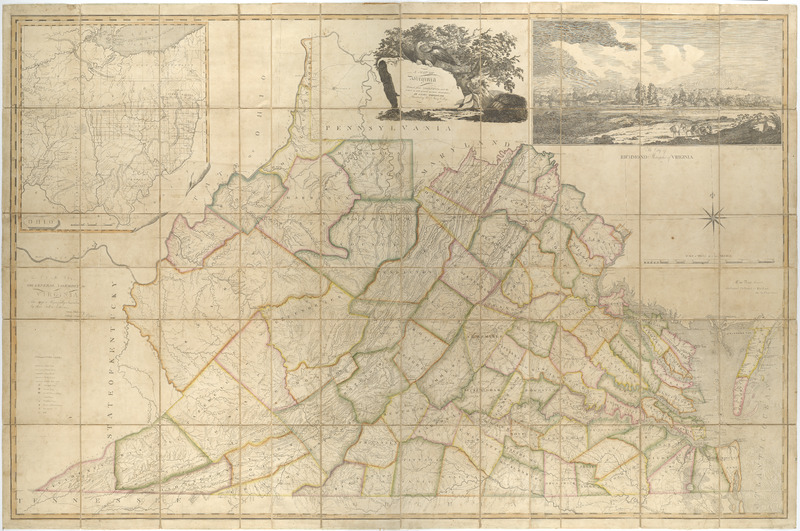
A Map of Virginia formed from Actual Surveys, and the Latest as well as the Most Accurate Observations
Madison, James, William Davis, and Fred Bossler. A Map of Virginia : Formed from Actual Surveys, and the Latest as Well as the Most Accurate Observations. Richmond: By the Proprietors, 1807. Map Collection, Library of Virginia, Richmond, Virginia, USA. https://lva.primo.exlibrisgroup.com/permalink/01LVA_INST/altrmk/alma990016112300205756
William Prentis supervised the map’s compilation and William Davis, prepared the final drawing. Frederick Bossler engraved the map’s copperplate. It was published in Richmond, Virginia on March 4, 1807, and dedicated to Virginia’s General Assembly.[1] Bossler engraved a “romantically inspired view of Richmond, along with the inset of the Virginia Military Tract. The cartouche emphasized nationalism and state loyalty, an eagle is perched on a rock bearing the map’s title, while tobacco plant and a sheaf of wheat symbolize Virginia’s agricultural economy.[2] The map details county boundaries, state and public roads, towns and villages, mills, ironworks, houses of entertainment and county seats. Unlike Fry and Jefferson’s map of the colony, only a few dwellings and plantations are noted. The state’s extensive drainage pattern of rivers and streams is depicted, and the mountainous region’s topography is emphasized.[3]
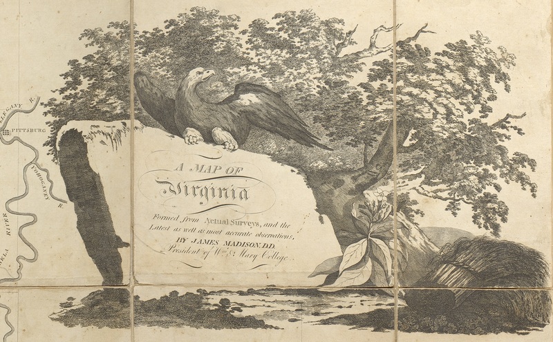
[Title from A Map of Virginia]
Title Cartouche. Madison, James, William Davis, and Fred Bossler. A Map of Virginia : Formed from Actual Surveys, and the Latest as Well as the Most Accurate Observations. Richmond: By the Proprietors, 1807. https://lva.primo.exlibrisgroup.com/permalink/01LVA_INST/altrmk/alma990016112300205756
Virginians had moved west after the American Revolutionary War and Bishop Madison’s map is a testament to this westward expansion; it is also a persuasive form of empirical evidence documenting Virginia’s profligation. Numerous counties had been added in the Appalachian Mountain range. Many of Virginia’s Revolutionary War veterans received bounty lands in Ohio for their three years of continental service, making it necessary for Davis to incorporate the Virginia Military Tract.
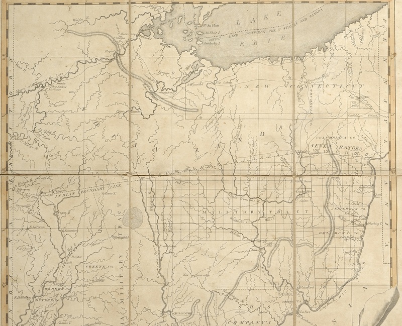
[Insert of Ohio and the Virginia Military District]
"Insert of Ohio and the Virginia Military District."
Madison, James, William Davis, and Fred Bossler. A Map of Virginia : Formed from Actual Surveys, and the Latest as Well as the Most Accurate Observations. Richmond: By the Proprietors, 1807. https://lva.primo.exlibrisgroup.com/permalink/01LVA_INST/altrmk/alma990016112300205756
The number of potential surveyors whose work contributed to this map is extensive. The Museum of Early Southern Decorative Arts Online Early Craftsman database lists approximately 160 surveyors who were active in Virginia in the late eighteenth and early nineteenth centuries who could have contributed to the map’s data.[4] Also, beginning in 1779, the Virginia Land Office retained all plats and surveys compiled to document grants issued. These were housed in Williamsburg, then Richmond, providing Bishop Madison with a plethora of data from the local county level.
_________________________________________
[1] See Henrico County Legal Document, 1807, David R. Ross vs. Frederick Bossler, 9 September 1807. Library of Virginia, Local Government Records Collection, Richmond, Virginia. These legal papers document copperplates and other materials related to the printing of the map to have been in the possession of Bossler, indicating that the map may have been printed in Richmond, Virginia, and not Philadelphia, Pennsylvania.
[2] Richard Stephenson and Marianne McKee, eds., Virginia in Maps: Four Centuries of Settlement, Growth and Development, (Richmond: Library of Virginia, 1999), 120-121.
[3] Ibid, 120-121.
[4] See Mesda Craftsman database, search by keyword “Va.,” and choose “surveyor” from the list of trades. https://mesda.org/.